Top Hiking areas in Victoria, Canada
Top Rated Hiking areas in Victoria

Top Reviewed Hiking areas in Victoria
Mount Wells Regional Park
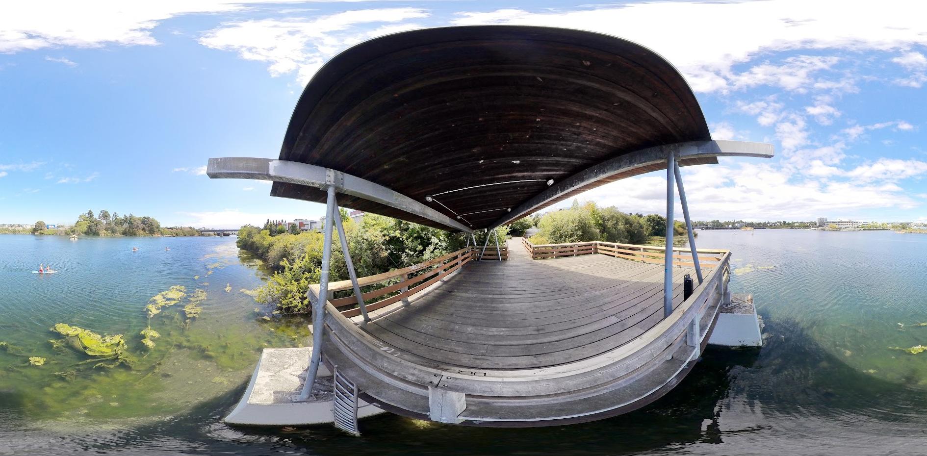
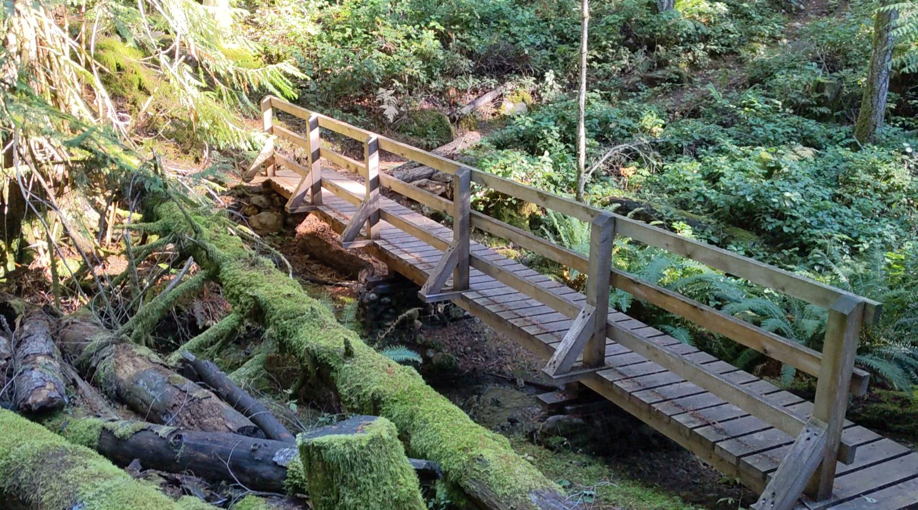
Bridge Way
Cuthbert Holmes Park
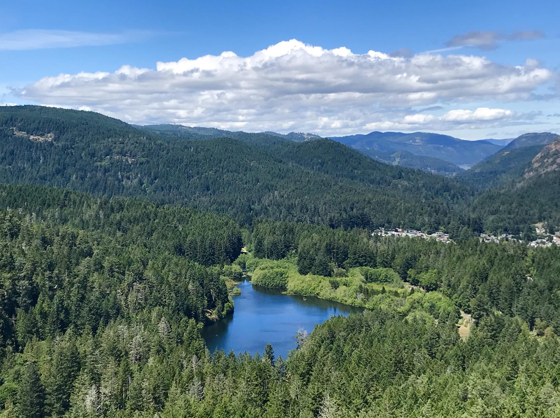
Mount Finlayson Trailhead

Ravensview Park

Bowker Creek Walkway
Access trail to King George Terrace
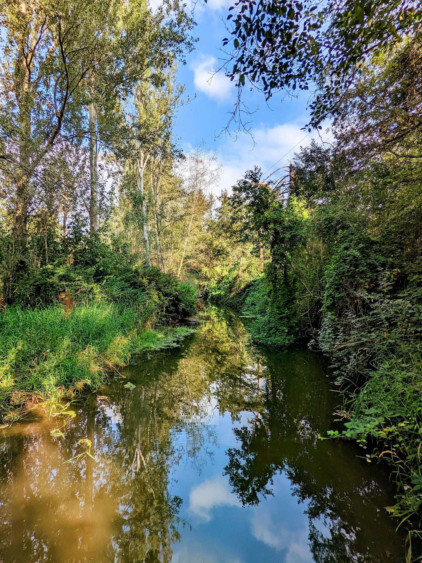
Colquitz River Trail
Galloping Goose Trail Start Victoria

Lone Tree Hill Regional Park
Mount Finlayson North Trailhead
Cascade Trail
Reviews


Nice place


This is a super fun hill to hike! Nice that there's a little parking lot and a bathroom at the trailhead too. The views are amazing and worth the effort.


Because it's summer, and we're In a drought, there was no waterfall, but if you continue down, you're greeted by a magnificent ocean view on the beach. I recommend taking the Makenzie back up as it's an uphill gradient instead of an up hill scramble, but that also depends on what kind of hike you want to do.

Very interesting pathway, quite different from the usual one in the city! A bit rusty but good.

Nice climb (about an hour to the top and back). Some slippery and steep spots, so shoes with good grip are suggested. Currently overlooking a development and there is some construction noise - kindof neat to see the development/construction from high above, but some may not appreciate that part of the "view". Overall good quick hike.


Very beautiful trail with amazing view specially during the evening/night!


A beautiful drive to get to this hiking trail and possibly drive right bye to 😃 like the other hike I did that morning this one for me was super easy 😁 the views up here are 🔥🔥💯💯❤️❤️ this one won't disappoint, so beautiful I love it❣️
A Nice place to hang out on a sunny day 😊 once you peak this, you get to see where else you can peak! With so many Mountains everywhere and Parks. Well at least that's what I did. Nice viewing areas once you get closer to the top, little breaks on the way. Again a really good hike 💯❤️🔥😎
A Nice place to hang out on a sunny day 😊 once you peak this, you get to see where else you can peak! With so many Mountains everywhere and Parks. Well at least that's what I did. Nice viewing areas once you get closer to the top, little breaks on the way. Again a really good hike 💯❤️🔥😎


A cute lil place inbetween city! Loved the shaded soft path for walking! Lots of native plants and wildflowers coming up in spring. I like how it is being restored to increase biodiversity. Will go often for my evening walks after shopping 🌳


Cuthbert holmes park is an nteresting green space that i always drive by but never stopped unltil today, ii has a few trails, bridges, paths and trails to explore along the river, it's an estuary to migrating birds and animals, easy hiking trails and a few interesting sights and things to explore
Worth a visit
Worth a visit


Great spot for views and photo opportunities! Absolutely loved this hike. Not too difficult. Totally worth the climb in elevation!


Great trail, great climb and amazing views of the CRD

Los amantes del ciclismo no podríamos tener mejor camino que el Galloping Goose, 54 ó 56 km de longitid, seguro, hermosos paisajes, compartido por ciclistas y peatones, simplemente..........hermoso! 🥰


Wonderful trails throughout! 👣
Great park for everyone to enjoy! Easy walking trails, dog leash friendly, birdhouses, bat-houses, friendly people out and about. Cross the bridge and there's Meadow Park? I think that's the name. Lovely playground for the older children. The climbing equipment is rated 2.5. Yrs and up.


Very easy course. As far as climbing with children. The summit overlooking Langford.


Great trail that takes you to the coast of the park; it starts combined with Timberman Trail, but then after about 15min there's a fork in the trail, whereby Cascade trail takes you to the right. It's pretty steep in some points; walk with caution!


Great hike. 30 minutes mild to medium difficulty. 5 different viewing platforms on the assent and at the peak. Cool-looking trees and moss formations on the way up as well.


I find this park a total surprise (in a good way) with shaded woodland trails in an urban setting. I’ve never found it busy. The entrance behind the arena is a bit tricky to find, I’ve posted a picture. It is just a bit beyond the children day care facility. I didn’t notice if there was parking.

Best bike trail ever

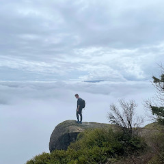
It is absolutely stunning here, definitely worth the hike. The view is breathtaking. SERIOUS WARNING, though: if you want to go to the top of the mountain, it is extremely treacherous. There are no guard rails or ropes to hold onto, the trail is very steep and the rocks are slippery even when they're dry. Do not attempt to climb it if you are not well prepared or have mobility issues, it becomes less of a hike and more of a rock climb towards the end and the drops are very far down. One slip and you could seriously hurt or kill yourself- it was a bit scary and easy to get lost. Otherwise it is absolutely gorgeous and if you come prepared and are safe you'll have a great time!


Beautiful place for a hike, swim and/or picnic! Really enjoyed my time on the trails here and would come back!


This is a lovely park with beautiful trails where I could walk my dog off leash. Well marked trails give a nice variety of routes and destinations such as Tillicum Mall.

Poorly marked, trails aren't maintained and there are fallen trees blocking the trail in many places. No cell service. Cougars and bears.


This is a great hike if you’d like to see a few different types of scenery, including hill top views of the city, the surrounding hills, lakes and more. The hike up from the parking lots gets progressively more difficult, with lots of tree roots and rocks to climb over and around.
The top of the hill has almost no trees for shade but the view is spectacular. There are also chain ropes along the way at the top to steer in the right direction (and to help you up some of the steeper areas.
The top of the hill has almost no trees for shade but the view is spectacular. There are also chain ropes along the way at the top to steer in the right direction (and to help you up some of the steeper areas.


The galloping goose trail is a lovely trail connecting Victoria to the other parts of the island: Saanich, Langford and Sooke.
Mainly for cyclists (lots of electric bikes on the paths), it’s also good for walks/hikes. Mostly paved and detached from roads, but some parts are along the highway or roads.
Mainly for cyclists (lots of electric bikes on the paths), it’s also good for walks/hikes. Mostly paved and detached from roads, but some parts are along the highway or roads.


We stopped by for an early evening walk - the trails were being enjoyed by small groups of all ages then around a corner we spied an owl near a nest. What a beautiful sight!

Trails are not maintained. Not marked or flagged. There are no trail signs. No cell service. Many obstacles on the trail. I would not recommend it to anyone but experienced, wildlife savvy Hikers. Easy to get lost and loads of evidence of bears and cougars.


rigorous and at times challenging . Wear supportive shoes! Such breathtaking views

Great trail with nice views over the Victoria area!


Nice for a walk in the woods. Be warned: Trails diverge without clear markers. No big views if you stay right, but still pretty. Many trails, so there is likely lots to explore.


Good hike and great views but trail can be a little hard to navigate


If you like adventure, try taking a different route when you come back from the top. You will eventually reach the arrows and the mountain will open up inside a forest. One of the best experiences of my lifetime. *WORTH YOUR TIME*. Loved the place and the scenic beauty. One of the most difficult trecks in Victoria

Awesome rigorous trail. Starts flat and gets steep at the top
This park is a nice quiet forested area at the start of the colwuitz Creek trail. Great horned owls have nested here recently, and the network of paths is great for off-leash dog walking.

Very senic

The galloping goose trail is a trail mainly for cyclists but also accesible for pedestrians.
The Galloping Goose Regional Trail is a 55-kilometre (34 mi) rail trail between Victoria, British Columbia, Canada, and the ghost town of Leechtown, north of Sooke, where it meets the old Sooke Flowline. (Source: Wikipedia)
The Galloping Goose Regional Trail is a 55-kilometre (34 mi) rail trail between Victoria, British Columbia, Canada, and the ghost town of Leechtown, north of Sooke, where it meets the old Sooke Flowline. (Source: Wikipedia)

We walked the Timberland trail (about 900 meters almost flat) followed by the cascade trail (600 meters, 150 meter elevation loss). We returned via the McKenzie bight trail.
There is a parking lot at the start of the McKenzie trail, where you can also start your hike to the Mount Work Summit.
If you start at the Timberland trail, you can park your car alongside the road.
Please be aware that the Ross Durrance Road is local trafic only.
There is a parking lot at the start of the McKenzie trail, where you can also start your hike to the Mount Work Summit.
If you start at the Timberland trail, you can park your car alongside the road.
Please be aware that the Ross Durrance Road is local trafic only.


The trail is 1.1km (100m elevation gain). It goes up steady and you are rewarded with an amazing view at the top.
There is a small parking lot for six cars and a toilet at the start of the trail.
There is a small parking lot for six cars and a toilet at the start of the trail.


Love this park, scenic, beautiful in any season. Great for feeding ducks birdseed, and taking photos. Its peaceful, and enjoyable.


Beautiful but an advanced hike for real enthusiasts. Bears and cougars have been reported as being more active in the area. Only experienced hikers should attempt.


Not recommended apart from for the most experienced hikers with all the proper necessary equipment. Bears and cougars are active in the area and the trail is not maintained or monitored by the CRD.


A lovely escape from the hussle and bustle of Royal Oak. Convenient location just off Brydon Park. Trail is level grade, dotted with picturesque wooden bridges. Downside is it's rather short and a risky endeavour when hard-core cyclists come tearing through. Safe travels!


Parking is tight at the McKenzie Bight parking lot but you should be ok if you can get there by 9:30am.
There is a good loop that takes around 2 hours if you head down the McKenzie Bight trail to the water and then back via the Cascade Trail and the Timberline Trail. Either way the trails are fairly steep but i suggest you head down to the water first and explore along the shoreline.
There is a pit toilet down there too.
Heading up on the Cascade Trail is good because there are lots of things to look at - the creek and the water falls as you climb up some stairs. There is a Bench to rest about halfway up.
At the top turn left over a bridge across the creek and through the forest back to the road.
You can make a longer trip by stopping for lunch at the ocean or by exploring the trails.


Here you can find a bike shop, a bakery and a coffee shop. And right where the trail follows the water way there is a totem pole and a CRD bike counter. From here heading North you cross the Gorge and come eventually to the intersection of the Galloping Goose and Lochside trails.
Great cycling ! Check out the counter.
Great cycling ! Check out the counter.

This lovely trail is quiet and spacious. It winds past a river and several playgrounds to playing fields and tennis courts. There are frequent access points and adequate parking.


Great hike on the Cascade trail. A little steep on the way down to the beach.

Great little trailhead into a great array of trails. Lots of options and some great views.


Nice trail system for all levels of walking!
Kids had fun searching for bugs 🐛, birds 🐦, fish 🐟, and painted rocks!
Kids had fun searching for bugs 🐛, birds 🐦, fish 🐟, and painted rocks!


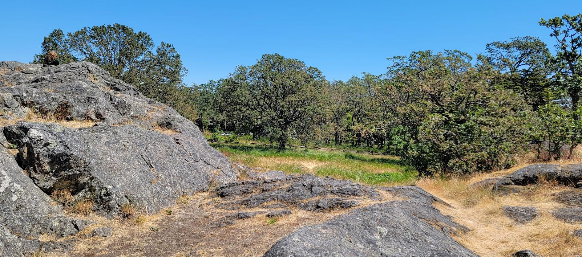
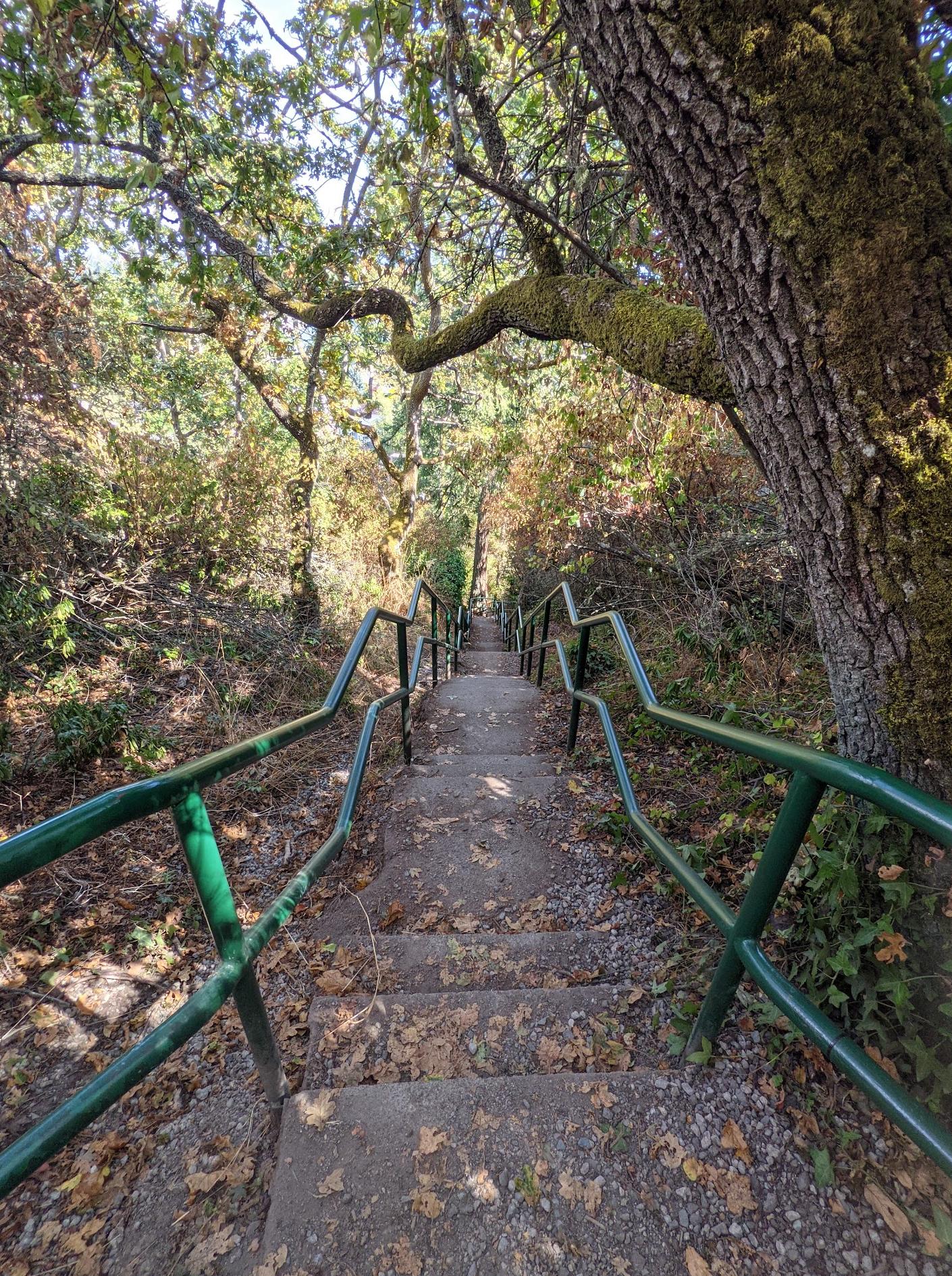
Drive up to Ravens View Drive and pull off the road to find a trail head that takes you into Mount Wells Park. You go down a steep path, cross a boardwalk and then walk 500 metres to another boardwalk crossing the creek - a fork left over the creek or straight on. If you go left you can get up to a lookout pretty quickly and then loop back to the fork.
The trail system is undeveloped so hard to follow but trails are often flagged with tape (see photos).
The trail system is undeveloped so hard to follow but trails are often flagged with tape (see photos).


Beautiful river trail


A very pleasant walk along a portion of the creek. Popular with strollers and a good shortcut for students on their way to Oak Bay High School. The pathway is a good warmup for activities at the recreation centre.


It looks like barely a creek but big salmon will soon be coming here to spawn. The municipality did a bunch of work on the creek bed over the summer. Great trails system too.

Thanks Victoria for installing the trail a few years back. We definitely love walking there... It's been a big part of my daily life. Again, thank you.

Bit muddy today but to be expected. Nice walk to firehouse. They've ruined the other section between Haultain and Richmond. Pulled down the bank greenery, chopped down trees and trucked in rocks and sandbags. Looks dreadful.

Breathtaking views from the summit. Well worth the climb.

We love coming here to feed the ducks. It's a great walk along the creek and is a convenient way to get into nature in an urban setting. The creek has been rehabilitated in places but needs work in other areas. One safety concern is the poorly constructed railings beside the creek that could allow small children to potentially fall into the creek.


Lovely little park that us great for walks with your dog or friends. Trails are well maintained and clearly marked. Would love it if they could expand it a bit more and replant native trees/plants in the spots were trails were made by people. Although it borders the construction of the McKenzie overpass you can barely hear it until you get much closer.


Great short but steep hike, about a kilometer each way but will definitely get your hear pumping. Beautiful views from the top!


Really great place for a hike. Blogs say this is a difficult hike, however if you are in good shape it’s pretty easy. It’s about 30 min to the top.
Dog friendly.
There are a few places where it is a little challenging and could be scary if you were elderly or very young.
I wouldn’t suggest an old dog go on this hike or someone faint of heart or needs assistance.
Views are wonderful once you get to the top.
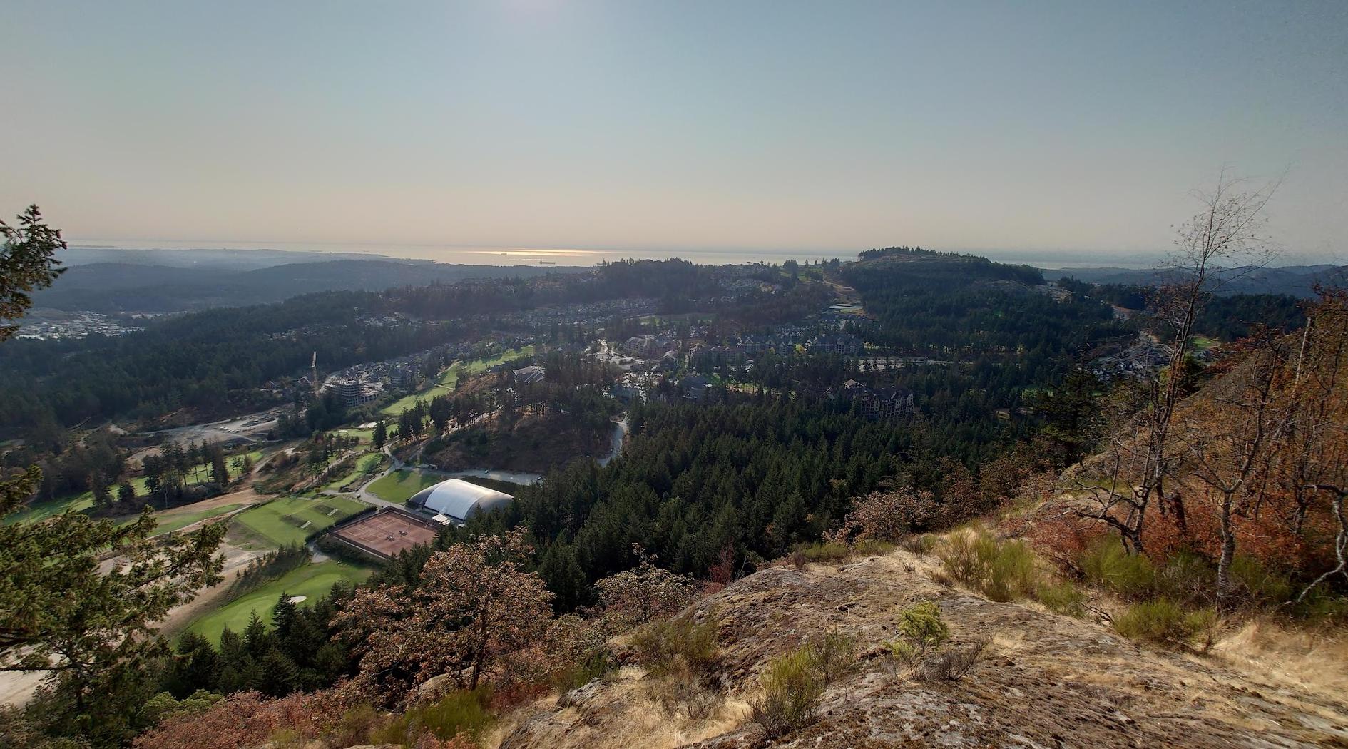
You can see downtown and the Olympic Mountains on a clear day!
Stick to the trails. I hear of people slipping and falling and getting hurt. Have fun!
Dog friendly.
There are a few places where it is a little challenging and could be scary if you were elderly or very young.
I wouldn’t suggest an old dog go on this hike or someone faint of heart or needs assistance.
Views are wonderful once you get to the top.
You can see downtown and the Olympic Mountains on a clear day!
Stick to the trails. I hear of people slipping and falling and getting hurt. Have fun!

Amazing hike!


Absolutely loved it! The views were gorgeous and the trail was rather easy. We had some of our engagement photos taken there and it was such a beautiful spot to go for a morning walk/hike. I would love to go back one day.

Expert hike!


A great trail that makes you feel in the middle of the forest even though you are right in town.


We hike this mountain a lot throughout the year. Amazing views of Victoria, Sooke Hills, Olympic Mountains and the Juan de Fuca Strait. Bank on 60 minutes round trip from the parking lot to the summit and back.


This is a great little walk down to great views of a cool waterfall. It's about an hour walk if you also go down to McKenzie Bight. I but only about 40 minutes just to the falls. Dog friendly. The falls are close to dry in the summer, but are best seen in the fall, winter or spring.


This hiking area is one of the best around victoria for access. The parking is good, and the trail is well marked out. It is a B3 hike (caloric value, followed by YDS technical difficulty). The views on the way up and at the top are great. It does get a bit slippery when wet. The right foot wear is very important. It's about 35 min to an hour sign to sign depending on your speed and ability.


Great place to hike. With 2 summits, and 2 different viewpoints from each one. Park at the Mt Wells parking lot. Then hit the trail. You will cross the flowline, then the road. Just keep following this well marked trail. When you get to what seems to be the summit take a look. Such a wonderful view of the Sierra city, Mt Finlayson, and Mt Mcdonald right next to it. On a good day Mt Baker is in plane site. Then head into the trees for the second viewpoint that brings you face to face with Mt Mcdonald to the west and the strait to the south and east. Wonderful trees. Rated as an A2 hike. (A for Sierra Club caloric value, and 2 for Yosemite Decimal System)


Amazing views, love this place. You just have to go! The parking lot is a bit small, so it's important to car pool if you can. The hike is 20 min or less, with the reward of views that are hard to beat in Victoria let alone the World. Not often are you able to see 270 deg views from a 20 minute hike!

Pleasant area, small river pond place where there's usually ducks. Little grass areas around, probably a good place for bocce ball or frisbee. Also a Pokemon gym. Close to Oak Bay High School.


Great trail, a bit of a steep hill to the beach. My wife and I were the only ones on the beach! Waterfalls are not that active in July.

Very plesent walk along the creek, plenty of ducks for the kids too. Newly refurbished sections worth wildlife areas and seating.


Great hike. Takes about an hour to get up with minimal scrambling. There are a couple of areas that need a little bit of care as they can be slippery, but there are chains and some ropes anchored around to help you up some of the more worrisome areas.

Beautiful walk along the creek any time of year. Forms part of an excellent walking route from Oak Bay High school to Oak Bay Avenue, where you can find shops, restaurants, banks, and coffee shops.