Top Hiking areas in Burnaby, Canada
Top Rated Hiking areas in Burnaby
Top Reviewed Hiking areas in Burnaby

Burnaby lake
Burnaby Mountain Urban Trail

Byrne Creek Trail
Burnaby Mountain Biking and Hiking Trails
Velodrome Trail
Trans Canada Trail
Southshore Trail
West Forest Trails
Byrne Creek Urban Trail
South Side Trail
Central Valley Greenway
Willingdon Jogging Trail
Reviews


Trail Series, Part 26
The Burnaby Mountain Trail has made me begin to wonder if I am developing a serious dependence on the British Columbia trail system. You see it doesn’t seem to matter how many of them I run, I only seem to long for more.
This location features a series of interconnected trails that are mostly technical in nature. I believe they can best be described as mountain bike trails that you are allowed to run or hike on. There are multiple bike jumps to navigate, numerous bridges to cross, frequent rocks and roots to avoid, and the downhills are fairly steep. Strollers and wheelchairs are not recommended and those with mobility issues would likely prefer to avoid this venue.
Although you’ll be surrounded by a dense blanket of trees, the trail offers occasional glimpses of some of the high rises in the greater Vancouver area.
I found ample available parking on the adjacent Simon Fraser University campus for a nominal fee.
If you’re ready for a technical run (or ride), this place is for you.
And that’s…Henry’s Take.
#vancouvertrails


What a beautiful hike it is, one should must go and enjoy


Pretty quite for a Sunday! Going back, we found the biking trail and hiking are different! Hiking trail was very beautiful!

if i could give zero i would.


It's not the most mind-blowing trail, but it's a cool spot for some fresh air and nature vibes. It's not deep in the jungle, so you'll catch some sun along the way. I think I'm not a fan of the lake because of all the lilipads. Overall, not a bad choice for a chill weekday walk!

No thing outstanding just so so


A peace of heaven. Stairs were a good practice of hiking with great views and surroundings

If you're going mountain biking and torn between 2 locations, pick the other location over Burnaby. Lots of the trails are permanently closed, the only fun trail was Lower snake. Will not be returning, one time is enough for me.


Great easy hiking trail with multiple loops. Good weekend hike for families with kids. Gotta pay park up at SFU and walk down.


Peaceful walk in the center of the city


Great exercise trail with more than 500 stairs! The incline is worth about 1/4 of the Grouse grind. This is perfect trail for winter months when lots of other hiking trails are unsafe.
I always start from mountain air park where parking is abundant. Be sure to go all the way up to the Burnaby mountain to enjoy the view!
I always start from mountain air park where parking is abundant. Be sure to go all the way up to the Burnaby mountain to enjoy the view!


With over 500 steps, it can be a bit tricky to get around when it’s raining. The view from the trail is amazing and totally worth it. As a beginner, I found it pretty tough, but I saw other hikers who were actually running. There are facilities and parking at the top at Burnaby Mountain Park. Overall, it was an awesome experience and a great workout.


Amazing views and a good practice for grouse grind


The Southside trail isn't too interesting and goes near the highway so you hear the noise. Parking was for around 30 cars.


A very neat and wonderful place to visit. Plenty of hiking trails here and great views of downtown and Port Coquitlam and other places.
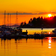
You have got to visit this for sunset time. I did take some photos. I hope you all like them
You have got to visit this for sunset time. I did take some photos. I hope you all like them


Lots of snow right now but still a fun trail but do dring a warm coffee with ya 😉 ☕️


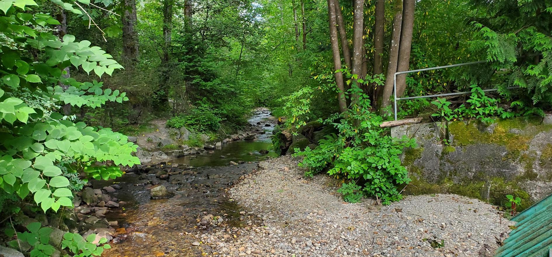
Byrne Creek is an urban stream that drains a large watershed on the south slope of Burnaby, BC, runs through a beautiful ravine park, and then eventually flows into the mighty Fraser River. In its urbanized state, much of the rain that enters the creek comes from rain drains (aka storm drains) on city streets and parking lots. This water is not treated. The creek is also the spawning ground for salmon and a very good place for birding. New Westminster BC. circa 2012.


It's a fun area. Some really lovely trails. I bring my dog & we had a blast yesterday running down snowy hills & through snow drifts. Families were up there with their kids. Was a nice wintery day.
"Cramp ons": If there is snow or ice buy a pair. Basically snow chains for your shoes.
We were able to run down a fairly steep decline.....no problem. A MUST for winter hikes.
I do the Grouse Grind a lot, there is a 1+ km section called "Trans Canada Trail". Nice winter Grind training. Hamstrings were pumped! Did a couple up & downs. Great!
Glad I tried the area. Can't wait for spring to really run through there.

Quieter trail if you are looking to get away from the Deer Lake crowds
Apparently you "can't bring your car"


A few trails interconnect. Gorgerous scenery. Velodrome involves many stairs (apparently >500).
I absolutely love this trail! So many breathtaking views of the forestry around. They have stairs and trail incorporated into the hike. At the very end, you'll notice it's extremely steep. But once you get passed the final steps you can lay on the grass and have a snack in front of the beautiful totems at Burnaby Mountain.


Great trails for mountain biking & hiking! Easy access from Simon Fraser University campus, the trails are well marked with signs and more importantly the trails are very well maintained. There is some construction when you come out halfway on the single track ( upper Mel’s ) but they usually have a flag person directing traffic. Overall great trail system !

Great trail, nice views and not too busy.


This is another level of the city parks. It is nice to live nearby as you don't need to drive all the way to West/North Van/Coquitlam. Family friendly hiking trails with slopes.


You can either reach the entrance of the trail from behind the Harry Jerome Sports Centre (bottom going up) or from Burnaby Mountain Park (top going down). Burnaby Mountain Park has more parking available than the narrow road leading up to the parking near Harry Jerome Sports Centre. It is quite a trek up the stairs with over 500+ stairs, but the view of the city and the waters is indeed beautiful at the top. Intermediate difficultly due to the elevation increase from taking so many flights of stairs. Would not recommend for those with little children to go up such steep stairs. Dogs must be kept on leash.


It's okay park.
Go here once in awhile to play my RC cars 😂
Go here once in awhile to play my RC cars 😂

Great place to take your little kids to.run around free and wild!!! Within reason of course, if you go off the beaten path there is lots of exposed roots. It's a fairly easy trail, just take your time and watch your foot!


I am new to BC and this was my first hike here. It was a misty magical morning.
-Parked my car at Burnaby Mountain conservation area parking just across Kushiro Park which has beautifully carved wooden sculptures.
- There are restrooms to use.
- I started my hike from Pandora trailhead which connects to Velodrome trail.
- The walk was peaceful with less to no crowd , slight drop and then comes the stairs😊
- There are 500+ staircases. Descending was super easy with great views to stop by and cherish. While coming up it was a great leg workout.
- It was a short 2.9 km out and back trail with good calorie burn opportunity.
I loved it and will visit again on a sunny day to get a clearer city view.

Very nice little trail. Also not as little as you'd imagine when looking on a map. There are multiple trails, even some going straight through the forest giving you an almost terrifying, but beautiful glimpse of the ravine.

Nice easy walk, short or long options. Walking all the way around Burnaby Lake is approximately 10 kilometres. Lots of birds and water fowl.


An amazing space! Simply serene with only the sounds of the creek.

Love this trail! Beginner friendly and great for going on a nice run.
Happy hiking!
Happy hiking!


Huge lake with multiple trails, mostly flat and easy to walk. It will take a couple of hours or more to walk around the lake (literally, around it). It’s quite, and dogs are welcome. The trail itself is next to the western painted turtle habitat, so take a look around, but be quiet not to startle them.
It gets dark quickly if you go around 5 or 6 in September, and it will be completely dark around 7:45, will need a flashlight to walk around.
You’ll see leech like insects crossing the road so be careful not to squash them.
It gets dark quickly if you go around 5 or 6 in September, and it will be completely dark around 7:45, will need a flashlight to walk around.
You’ll see leech like insects crossing the road so be careful not to squash them.


Local trail , 3+ km , enjoy your walk and respect local habitants : coyotes, owls , rabbits , etc. Please stay on existing main trails , keep our park clean - enjoyable for humans and animals .

Awesome cycling path!

Peaceful place to get away from the hustle and bustle of city life even if only for a while.

Whom ever made the elephant sighting sign is pretty funny but there have been bear sightings so please be careful with your children or pets.

Excellent bike path. The stretch from Commercial SkyTrain station to Deer Lake is fairly level. Good for beginners.


Park at the north end of residential Sussex Ave. A few steps in you will see a signboard for the West Forest Trails. Bordered to the east by Royal Oak Avenue, it is not a long trail, but it is very twisty with a lot of ups and downs. The first fork goes south to a second choice of Kira Court or into Forest Glen Park. This is a large open park on a rolling hill. In the park, staying on your left you will see a trail that leads back down. The trail forks again going back to Sussex, or a right turn continues to Royal Oak Ave.
There are various small bridges and one large one that has a bit of a view of the wetlands and access to the stream. The hum of traffic on Deer Lake Parkway is always there, but it is still a nice atmosphere. You will see various small paths off the main trail. There were posted signs re bear sightings, so I decided not to investigate.
The trail does not terminate at Royal Oak as it shows on Google maps. You can continue on a path beside Royal Oak to Deer Lake Parkway that connects back to Sussex Ave. The path does show and continue to Deer Lake and its trails. Combined, you could turn it into an all-day hike.
West Forest Trails is a nice 30 min to 1 hour jaunt.
Daniel


Beautiful!!! Be careful though....the rocks in the creek are slippery.


Lovely peaceful trails off the main road.


Fall is the best time to walk here. Many colorful spots around the park.

This is our hiking path. We do 45 round trip walk from Victoria drive along central valley. We love all the hummingbirds and robin and especially bluejays. Low impact and lots of room to walk and run as long as the bikes stay on their own path!!

Very nice and improving. They are doing work on Gilmore traveling north and it is still rough.

Decent view. Plenty of space on the trail and good for dogs too

Nice quiet hiking trails

What a nice place to hike

Amazing trails.
Best free activities for your days off
Best free activities for your days off

Central Valley greenway is a peaceful bike and walking route through Burnaby between Brentwood and HWY 1. Part of the Greater Vancouver urban trail network. I love to watch the beavers, otters, herons and other assorted wildlife in the area.

Nice local park with trails and streams. Very close to those great trains so you can hear it quite frequently. Lots of wildlife like squirrels and birds and also owls.

Hiking trail only - no bikes, no horses.
There is a viewpoint on the west end of this trail, across from Piper Spit.
This trail is part of the Burnaby Lake Loop - there are signs at every trail junction to direct you which way to go for the Loop.
There is a viewpoint on the west end of this trail, across from Piper Spit.
This trail is part of the Burnaby Lake Loop - there are signs at every trail junction to direct you which way to go for the Loop.


Lush nature and not too crowded. Trail distance is good enough for an hour's hike. Easily accessible right in the city.


Great trail. Going down also make u tired too. Are these the lights which I used to see from driving highway 99 at night?😆

Excellent public space. Some areas could be cleaned up a bit but 5 stars for excellence


A beautiful, short trail to hike and adventure.
Beautiful view on the top of the trail.
24/7 and free, access with other trails.
Beautiful view on the top of the trail.
24/7 and free, access with other trails.

A fun trail to hike and do adventures.
Beautiful view, 24/7, free.
Beautiful view, 24/7, free.


Lovely trails and very beautiful.
Perfect afternoon walk to escape the busy city.
Enjoy 2 hours here easily.
Perfect afternoon walk to escape the busy city.
Enjoy 2 hours here easily.

Beautiful trail, about 2h to walk around the lake. There are some good view points with ducks, fishes, etc.


Well marked. Lots of shaded areas. If you do the entire trail bring hiking poles and plenty of water!

Pretty nice trail, yet lots of mosquitoes as you begin to sweat. Get some bug spray before you go.

I love this place absolutely love it! My girlfriend and I go for walks here all the time. It's pretty amazing, so many beautiful views and trees. Amazing!


Love to bike on this quiet trail


Great walk in what seemed like enchanted forest with high tree canopy.

The E section beyond Willingdon alongside the Creek is rugged and quiet😁


Amazing spot to walk or run.


Nice ride.
It is possible to ride up to the campus from Forest Grove Park avoiding Gaglardi Way. There are trails through the Park that connects with the TransMountain trail. Follow the trail up under the powerlines near the Kwekwecnewtxw (Coast Salish Watch House). It is a little overgrown at the creek crossing but otherwise ok. At Gaglardi (there is NO crosswalk) connect with the service road then Water Main trail (steep) on the other side.
It is possible to ride up to the campus from Forest Grove Park avoiding Gaglardi Way. There are trails through the Park that connects with the TransMountain trail. Follow the trail up under the powerlines near the Kwekwecnewtxw (Coast Salish Watch House). It is a little overgrown at the creek crossing but otherwise ok. At Gaglardi (there is NO crosswalk) connect with the service road then Water Main trail (steep) on the other side.
Good all season crushed gravel trails for walking, jogging, or biking. Trail connects with Deer Lake Park through Royal Oak underpass and North-South Bikeway (Sussex).

I feel grateful to the City of Burnaby for maintaining such a beautiful trail network in this park which is a real urban recreation jewel. I only wish it was connected across HWY 1 to the other interurban forested areas south of the highway to create a green continuum for more extensive hiking experience. Also, the west end of the North Lake trail currently terminates with dead end in the dense bush without reaching the western boundary of the park, and it's a pity, as extending the trail wouldn't be too difficult or expensive.


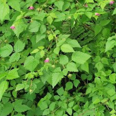
Very beautiful. I loved the trails. Me and my little puppy had a wonderful little stroll through the trails picking raspberries. :)


This is a trail loop alongside the most beautiful section of Byrne Creek meandering in a breezy forest with a distance of 3.5 km and an elevation gain of some 40 m.

Bike or walk this paved path from downtown Vancouver to New Westminster. Be sure to rest along the way !


Very good trail for walking. You may see horses and theire riders.


This is a part of the trail accessible near West Mall at SFU.